
The Ngorongoro Conservation Area is a protected area of about 8,292 square kilometres in northern Tanzania that includes far more than the famous crater. It stretches from the forested Ngorongoro Highlands to the short-grass plains of Ndutu on the edge of the Serengeti, and it protects volcanoes, crater lakes, migration calving grounds, Olduvai Gorge and some of the oldest human footprints ever found. Unlike a national park, it was set up to allow people, livestock and wildlife to share the land.
This guide explains how the conservation area works, what is inside it, the fees and rules that apply, and how to explore beyond the crater.
Ngorongoro Conservation Area at a glance
| Fact | Detail |
|---|---|
| Size | About 8,292 km² |
| Established | 1959, separated from the Serengeti |
| Managed by | Ngorongoro Conservation Area Authority (NCAA) |
| Status | UNESCO World Heritage Site (natural 1979, later also cultural); part of the Ngorongoro-Lengai UNESCO Global Geopark |
| Main gate | Lodoare (Loduare) Gate, near Karatu |
| Western exit | Naabi Hill Gate into the Serengeti |
| Highlights | Ngorongoro Crater, Olmoti and Empakaai craters, Olduvai Gorge, Laetoli, Ndutu plains, Lake Masek, highland forest |
Conservation area vs national park
Tanzania’s national parks, such as the Serengeti and Lake Manyara, are managed by Tanzania National Parks (TANAPA) purely for wildlife and tourism. People do not live inside them.
The Ngorongoro Conservation Area is different. It was created in 1959 as a multiple land-use area with three goals: to conserve wildlife and natural resources, to protect the interests of the Maasai and other residents, and to promote tourism. For decades, Maasai families have grazed cattle, goats and sheep across the highlands and plains, often within sight of wildlife.
That balance has come under strain as human and livestock numbers have grown. Since 2022, government programmes have moved thousands of Maasai residents to settlements elsewhere in Tanzania, a policy the government presents as voluntary and necessary for conservation, and which human rights groups and many Maasai have strongly criticised. Visitors will still meet Maasai herders in the highlands, and cultural visits are available.
What is inside the Ngorongoro Conservation Area
The Ngorongoro Crater
The star attraction: a collapsed volcano about 260 km² in size and around 600 metres deep, with about 25,000 large animals on its floor, including lion, black rhino, elephant, buffalo and hyena. Read our complete Ngorongoro Crater guide.
The Ngorongoro Highlands
A chain of old volcanoes covered in montane forest and grassland, including Olmoti, Empakaai, Lemagrut and Oldeani. The highland forest is home to elephant herds, buffalo, bushbuck and colobus monkeys, and it catches the rain that feeds the crater below.
Olmoti Crater
A shallow crater north of Ngorongoro, reached by a short ranger-led walk. The Munge River starts here, tumbling over a waterfall before flowing into the Ngorongoro Crater.
Empakaai Crater
A deep, steep-sided crater with a soda lake that often holds flamingos. A ranger-led hike down the walls takes about an hour each way. On clear days the rim gives views towards Ol Doinyo Lengai, the Maasai’s sacred volcano, and sometimes Kilimanjaro.
Olduvai Gorge
A steep ravine where Mary and Louis Leakey and later researchers found fossils and stone tools that changed our understanding of human evolution. A museum and viewpoint sit on the road to the Serengeti. Read our guide to Olduvai Gorge.
Laetoli
South of Olduvai, Laetoli is where a trail of footprints left by early human ancestors about 3.6 million years ago was found preserved in volcanic ash. A replica and small display can be visited.
Ndutu and Lake Masek
In the south-west, the conservation area merges with the Serengeti plains. From about December to March, the Great Migration herds gather on the short grass around Lake Ndutu and Lake Masek to give birth, and predators follow. Ndutu has long been popular with photographers; ask your operator about the current rules on driving off-road there.
Shifting sands and Nasera Rock
Smaller sights include the Shifting Sands, a dune of black volcanic ash that slowly moves across the plains, and Nasera Rock, a granite outcrop in the Gol Mountains area.
How the conservation area changes through the year
| Months | Crater | Highlands | Ndutu plains |
|---|---|---|---|
| December to March | Green, fewer vehicles | Green, cool nights | Migration herds and calving, peak predator action |
| April to May | Lush, quiet, some mud | Wet, misty | Herds start moving north-west; some camps close |
| June to October | Dry, clear, busiest | Cold nights, clear days | Dry and quiet; resident wildlife only |
| November | Short rains, green again | Showers | Herds begin returning south |
The Maasai and visiting a boma
Many visitors stop at a Maasai boma, a homestead of round houses inside a thorn fence, on the drive through the highlands. Visits usually include a welcome song and dance, a look inside a house and a chance to buy beadwork. They are a source of income for families, but some feel staged. The better approach is to ask your guide for a community-run visit where the fee goes to the village, to ask before taking photos and to buy beadwork only if you like it. Remember that the Maasai’s future in the conservation area is a sensitive political issue; listen more than you ask.
Fees and rules
All visitors pay the conservation fee for each 24 hours inside the conservation area, about US$70.80 per non-resident adult at 2026 rates. Each vehicle going down into the crater also pays a crater service fee of about US$295 per descent, and lodges inside the area carry a nightly concession fee. Activities such as walking safaris and hikes to Olmoti or Empakaai carry extra fees and require a ranger. See Ngorongoro fees explained for worked examples.
- A licensed guide is required for all game drives.
- Walking is allowed only with an armed ranger, and only in permitted areas.
- Off-road driving is banned in the crater; check current rules for other areas with your guide.
- Drones need special permits.
- Gates generally open at 6:00 AM and close at 6:00 PM.
How to explore beyond the crater
Most visitors see only the crater, which is a shame. With an extra day or two you can add:
- A highland walk to Olmoti or a hike into Empakaai Crater with a ranger.
- Olduvai Gorge and the Shifting Sands on the way to or from the Serengeti.
- Ndutu from December to March, for the calving season.
- A Maasai cultural visit, arranged through your guide.
- Endoro Falls and the elephant caves, a forest hike on the conservation area’s edge near Karatu. See our guide to Endoro Falls.
Where to stay
You can stay inside the conservation area, on the crater rim or in the highlands, or just outside it in Karatu. Lodges inside are closest to the crater but carry nightly concession fees and much colder nights. Karatu, at about 1,500 metres, is warmer, has larger lodges and is 20 to 40 minutes from Lodoare Gate. Read where to stay near Ngorongoro Crater.
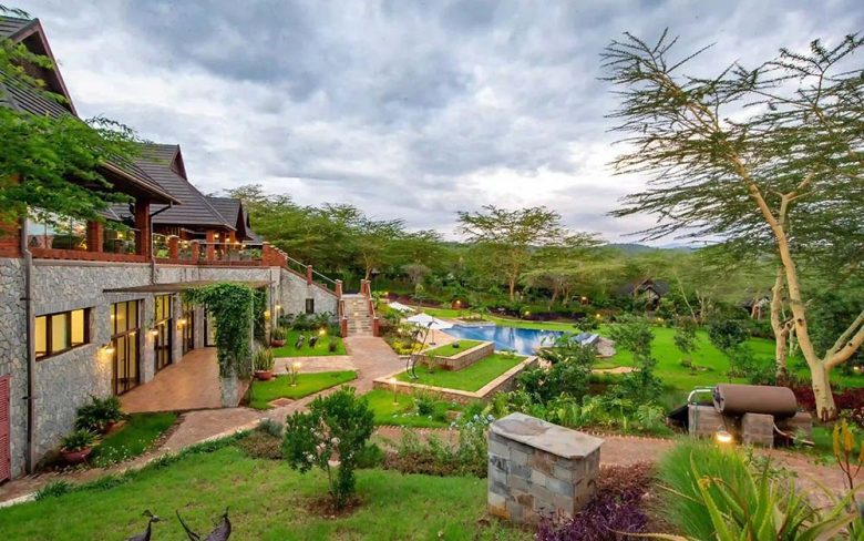
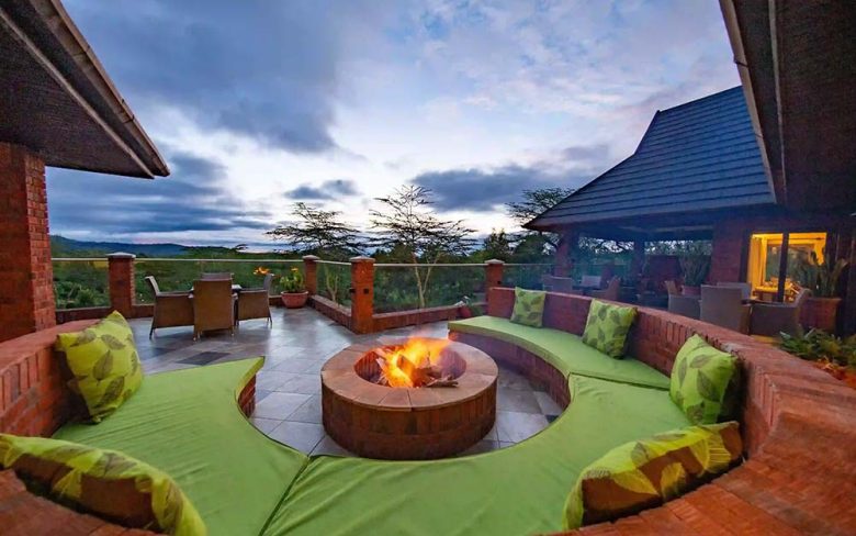
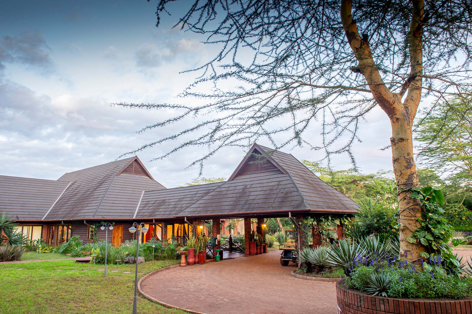
Our lodge, The Retreat at Ngorongoro, sits on the forest edge in the Tloma area of Karatu, with 30 standalone villas, an infinity pool, a spa and food from our own gardens. See our villas.
Questions about the Ngorongoro Conservation Area
Is Ngorongoro a national park?
No. It is a conservation area managed by the Ngorongoro Conservation Area Authority, designed for wildlife, people and tourism to share the land.
How big is the Ngorongoro Conservation Area?
About 8,292 square kilometres, far larger than the crater itself, which covers about 260 square kilometres.
What is there to see apart from the crater?
Olmoti and Empakaai craters, Olduvai Gorge, the Laetoli footprints, the Ndutu plains and calving season, the Shifting Sands and highland forests.
Do Maasai live in the Ngorongoro Conservation Area?
Yes, Maasai communities have long lived and grazed livestock here, although government relocation programmes since 2022 have moved many families elsewhere.
Planning a few days in the Ngorongoro area? Check availability at our lodge in Karatu.